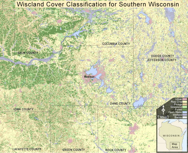
Land cover is defined as the observed (bio)physical cover on the earth’s surface. This land cover map of south-central Wisconsin was created from the WISCLAND land cover data set that was developed by and named after the Wisconsin Initiative for Statewide Cooperation on Landscape Analysis and Data.
WISCLAND was derived from LANDSAT TM satellite imagery that was processed, classified, and ground-truthed to create a 30-meter resolution, state wide, land cover classification scheme that includes 42 potential land cover types.
For this map we have narrowed down the 42 original classifications into eight broader categories:
- Urban
- Row Crop
- Forage crop
- Grassland
- Forest
- Open water
- Wetland
- Barren
This map’s intent is to provide a general idea of today’s distribution of land cover in southcentral Wisconsin.
View additional information about the WISCLAND dataset (pdf)